interkriti®
YOUR GATEWAY TO CRETE
|
Crete
: Regional Interest
List Grid Map
Found
62
- Showing :
21 - 40
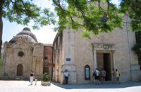 Iraklion at 14.4km (E) Agia Ekaterini church and Exhibition of Byzantine Art and Ecclesiastical objects. A small sinaitic church of St. Catherine with a Basilica design, houses an exhibition with works of art from the Cretan renaissance. Among the exhibits are some of the most important icons of the Cretan School, ecclesiastical books and manuscripts, vestments, ecclesiastical vessels and relics, wall-paintings, wood-carvings and sculpture. 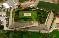 Iraklion at 14.4km (E) The bastion heart shaped in plan with an acute angle, has two "piazza bassa" and one cavalier. It defines the southeast and the highest part of the fortification. Its name is due to Gabriele Tadini Martinego (1520) who started the construction of a circular tower at the place of the later bastion. It was one of the strongest bastions (the others were that of Pantocratora and that of Vittouri) which also suffered the main attack and most of the bombardment from the Turks. On the top of the bastion itself there was made a cavalier (which looks like a smaller bastion), whose main purpose was the better defense and control of the area around the bastion. The grave of Nikos Kazantzakis, the famous Cretan writer, is situated on the highest point of the Venetian fortification at the Martinego cavalier. The inscription by the wooden cross reads: " I hope for nothing. I fear nothing. I am free ", a phrase taken from "The Odyssey" which Kazantzakis considered as one of his most significant works. The playgrounds of the Academy of the local football team "Ergotelis" are located today on the main bastion and in the ditch around the bastion are the botanical gardens of the city. Image Library
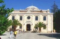 Iraklion Old Town at 14.7km (E) With the recovery of Crete from Nikiforos Fokas (961AD), the seat of the bishopric is transferred from Gortyna to Chandakas, which became the capital of the island. The new cathedral, which is the most established and largest in the city, is dedicated to the Apostle Titos. Here, amongst other relics, there are gathered the Holy Skull of the Apostle and the miracle working icon of Messopapaditissas. Image Library
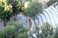 Anogia at 14.8km (SW) The artistic events, which take place every year in the first week of July at the same place called Fourni and in the Cretan village of Anogia. The poet, songwriter and singer from Anogia, who they call "Loudovikos from Anogia" wants to make the history of the young martyr, who supersedes his fear in love known to the public. And because 1.900 years have passed since the martyrdom of Yakinthos, he decided to honor the Saint of Love and sing together with him of the poetry of love.(www.yakinthia.com)
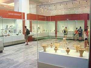 Heraklion city at 14.9km (E) The most magnificent collection of Minoan art and culture in the world, unique in beauty and completeness is housed in this museum. The exhibiton of the museum is organized in chronological order, ranging from the Neolithic period to the Roman era (4th century A.D.) and geographically, according to the provenance of the finds.
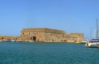 Iraklion Venetian port at 14.9km (E) A seaside fortress situated at the entrance of the old harbour. It was built by the Venetians, before the construction of the new Venetian fortification, in order to protect the pier and the port. It took its last shape in the years between 1523 - 1540 replacing another construction destroyed by an earthquake. Image Library
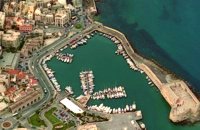 North - Central Crete at 15.5km (E) Iraklion (Heraklion or Herakleion GR: Ηράκλειον) is the largest urban centre in Crete, the capital of the region and the economic centre of the island. The first European civilisation, the Minoan civilisation, flourished on this land 5000 years ago. Currently the population of Iraklion is approximately 150.000 people. It is a very dynamic and cosmopolitan town, particularly during the summer period when thousands of visitors can be seen shopping in the market or visiting the museums and other places of interest. Today Heraklion is the top choice for tourist destinations in the Mediterranean. The city is also the commercial and scientific centre of the island. During the last 20 years the city has made remarkable progress in the academic and technological fields...
Image Library
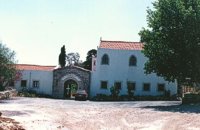 Malevizi, Iraklion at 15.6km (S) The monastery of Aghios Georgios the Gorgolainis (GR: Αγιος Γεώργιος Γοργολαΐνι) is located on an altitude of 400 m close to the Kato Asites village. It survived through several revolutions and wars during the Ottoman occupation.  Malevizi, Iraklion at 16.1km (S) Kato Asites (GR: Κάτω Ασίτες lies 23km from Iraklion and 5km from Agios Myron at 450m a.s.l with 1113 inhabitants. Beautiful town with traditional architecture especially the quarters "Notiko", "Prinos" and "Kastella" close to the monastery of Gorgolaini. Other interesting sights are: The thermae of the king of Prinias, The uninhabited settlement of Nisi with traditional houses, the caves "Lesta spilios" at Marias aloni, "Astirakou spilios", "Sarakina" and "Katsivli spilios" at Lyssogremia and "Melissa", The chapels of "Panagia" aged 800 years, "Agios Antonios" aged 1000 years, "Agios Georgios" and "Agia Paraskevi". The patron Saint is "Agia Paraskevi" celebrated on the 26th July . 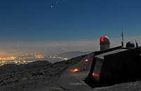 Idi mountain at 16.4km (SW) Located at the top (1750m) of Skinakas mountain of Idi (Ida) mounatin range, 60km from Heraklion. There are two telescopes and modern equipment and facilities both for research and educational activities in astronomy. It is a department of the University of Crete. Skinakas observatory offers a number of open days each year. This gives the opportunity to visitors to be introduced to the operation of the observatory, to get informed about the latest achievements in Astrophysics and to observe through the telescope. Open days for the year 2012: August 26 September 23 During the open days the Observatory facilities can be visited from 17:00 to 23:00. Due to low temperatures at the Skinakas altitude, warm clothes are highly recommended. The visitors will have the opportunity to be guided through the Observatory's infrastructure and follow a related presentation. The road to Skinakas Observatory is very narrow. Accident may occur and the space is limited on the top. For the reasons above, buses are not allowed (advised) to visit the Observatory during open days. Website : http://skinakas.physics.uoc.gr/  Malevizi, Iraklion at 17km (S) Ano Asites (GR: Ανω Ασίτες) lies 24km from Iraklion and 6km from Agios Myron at 480m a.s.l with 423 inhabitants. A big part of the surrounding area is covered by forest on the eastern side of the mountain Psiloritis. Near the village there is the Byzantine chapel of Agios Antonios located in the ravine with the same name a place of exceptional natural beauty. From here passes the European Hiking Path (E4) which leads to the shelter "Prinos" ( of the Mountaineering Club of Iraklion - altitude 1100 m a.s.l.) located in a holly (=prinos) forest. 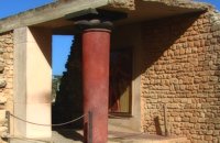 Palace and Archaeological site at 18.1km (E) The famous Palace of king Minos and the centre of the Minoan civilisation 5km south of Iraklion. The Great Palace covered an area of 20.000 sq. meters and had 1.400 rooms. Every section of the Palace had a specific use. In the west side of the Palace were the chambers of the ceremonies, of the administration and of the public storehouse...
Image Library
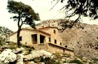 East Ida mountain, Iraklion at 18.1km (S) Prinos refuge at Prinos on Psiloritis mountain (Ida), is at 1100 metres. It can sleep 25 people, it has cooking facilities, two wood burning stoves for heating and a rainwater tank. Access is through the village of Ano Assites in Malevizi around 22km from Iraklion. From there a two kilometres of dirt road leads to a place called Melisses and then a one-and-a-half hour walk along a footpath signed with red marks, to the refuge. Prinos hut was built in 1962 and was renovated around 1992. It is run by the mountaineering club of Heraklion. The view from Prinos to the north and east is great. 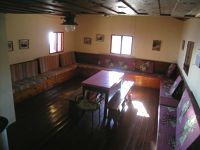 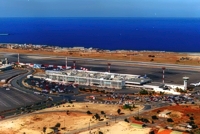 Iraklion ( Nea Alikarnassos) at 18.2km (E) Heraklion International Airport, "Nikos Kazantzakis" (Greek: Κρατικός Αερολιμένας Ηρακλείου, "Νίκος Καζαντζάκης") or Nikos Kazantzakis International Airport (IATA: HER, ICAO: LGIR) is the primary airport on the island of Crete, Greece. It is located about 5km from the main city of Heraklion. Heraklion International Airport is is one of the biggest in Greece and receives approximately 15% of the total tourist traffic of Greece. There are many airlines currently operating flights from Athens and Thessaloniki to Iraklion (Olympic Airways, Aegean Airlines and others), while during the high season there are flights from/to Rhodes, Mykonos, Santorini and other Greek islands. There are also international airlines that connects Iraklion to other European cities. During the summer season there are numerous chartered flights to Iraklion from all over Europe (mainly Germany, the United Kingdom, Russia, and Holland). During the summer months there is a huge increase in air traffic that peaks in August (approximately 130 flights per day). Major car-rental companies have desks at the airport. Taxi and public bus are available for transfer from/to Iraklion. 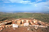 Archanes at 18.6km (SE) Anemóspilia (GR: Aνεμόσπηλια). Anemospilia is an archeological site at the northern foot of Mount Yuchtas, in the prefecture of Heraklion in Crete. A rectangular building has been found which dates from the Minoan era and was destroyed by an earthquake in the 17th century BC. The building with three narrow chambers, each opening into a long corridor to the north, which extends along the whole width of the building. The area is enclosed with a stone wall and the whole structure has been interpreted as a shrine; in the central room was found a "xoanon" (statue) of the deity worshiped here. In the west room, where the altar stood, was uncovered, according to the excavator, the first human sacrifice to have ever taken place in Minoan times. (although this view has been challenged). The building at Anemospelia was used for only half a century, as it was suddenly destroyed by an earthquake in the middle of the 17th century B.C. The site was excavated in the summer of 1979 by John Sakellarakis.  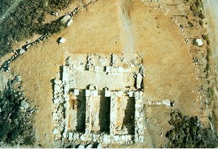 Aerial view 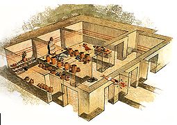 Shrine model Links: Minoan Religion (Foundation of the Hellenic World) 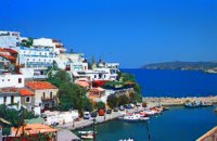 Rethymnon North coast at 18.7km (NW) Bali is a small fishing village, about 40 km west of Iraklion and 37km east of Rethymno easily accessed from the international road. It has a small picturesque harbour and lots of small coves with wonderful clear beaches. Recent years Bali has been developed to a popular tourist resort but it is still preserves its traditional character. Ideal place for family holidays, with small hotels and lovely taverns serving fresh fish and local specialties. 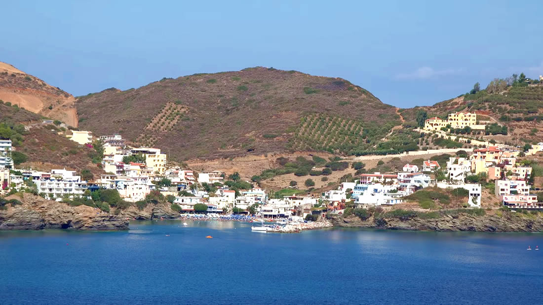 The Venetians called the place "Atali", from its ancient name which was "Astali", while its current name was given by the Ottomans. There is also the Atali Monastery nearby, which retains the medieval name of the place and is dedicated to Saint John. The monastery is built on a small elevated peninsula overlooking the bay and the Cretan sea. Image Library
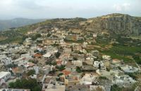 Iraklion at 19.2km (SE) The town of Profitis Ilias (GR: Προφήτης Ηλίας), or Roka for the locals, is found 20km south of Heraklion It is built on the top of two hills offering an unforgettable view to the surrounding areas. A natural fortification, due to its position, it has been suggested that ancient Lycastos was built here. It is also known as Kandli Kasteli due to the castle located at the summit of a rock southeast of the town. Nikiforos Fokas built the Byzantine castle of Temenos in the same location in 961 when he freed the island from the Saracens. His objective was to bring the city of Hantaka (Heraklion) into the castle of Temenos. However, this did not materialize and the city remained were it was. In the thirteenth century the castle of Temenos was occupied by the Genoese Pescatore, and later by the Venetians. The name Kanli Kastelli in Turkish means blood-painted castle, and took its name from a massacre of Turks by the Venetians and Greeks that took place here in 1647. 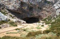 Psiloritis Mountain at 20.1km (SW) At 1538m above sea level, 20 km. south of the traditional town of Anogia , on the plateau of Nida, of Mountain Psiloritis, lies this sacred cave, where according to mythology, Rhea, Zeus' mother, hid the new born Zeus in this cave in order to protect him from his father Kronos (Saturn), who was in the habit of swallowing his children because he feared they might deprive him of his power. Hidden in that cave Zeus grew up being fed with the milk of the goat Amalthia, while the 'Kourites" covered the child's crying through banging their copper shields. Image Library
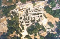 Archanes at 20.3km (SE) Excavations at Phourni have brought to light 26 buildings, most of which had funerary use. The cemetery was used from 2400 B.C. until 1200 B.C. and each complex had more than one architectural phase. Most of the funerary buildings were used for many decades and contain successive burials. Excavations were begun in 1964 by Efi and John Sakellarakis and have been continued until today (1995) with short interruptions. Most of the buildings are preserved in good condition. 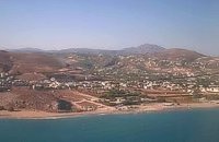 Iraklion at 20.5km (E) This 2 km long sandy beach was for years and still is the favorite beach of the people of Heraklion town. It is named after the river "Karteros" which outflows at the west end of it near the airport. The water is clean, the seabed is sandy with smoothly shelving and swimming is safe. The access is free in most parts except for some areas that are reserved for military personnel and the municipal beach "Akti" where visitors should pay an entrance fee in order to use the facilities. At the east end there are some very good taverns offering fresh fish among their specialties and are very popular with locals and tourists alike.
Image Library
|
||
|
| ||
C
O
N
T
E
N
T
S
O
N
T
E
N
T
S


