interkriti®
YOUR GATEWAY TO CRETE
|
Crete
: Regional Interest
List Grid Map
Found
101
- Showing :
61 - 80
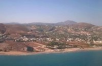 Iraklion at 25.3km (NE) This 2 km long sandy beach was for years and still is the favorite beach of the people of Heraklion town. It is named after the river "Karteros" which outflows at the west end of it near the airport. The water is clean, the seabed is sandy with smoothly shelving and swimming is safe. The access is free in most parts except for some areas that are reserved for military personnel and the municipal beach "Akti" where visitors should pay an entrance fee in order to use the facilities. At the east end there are some very good taverns offering fresh fish among their specialties and are very popular with locals and tourists alike.
Image Library
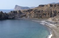 South Iraklion at 25.4km (S) Tráfoulas is a secluded beach, nested in a cove open to the south, at the small promontory of the same name, located between Lendas and Trypiti. You can reach Trafoulas only by boat or on foot via a small canyon. The starting point is around 700m away, to the north, just above the small harbour of Loutras, around 5km east from Lendas, where there is a place for parking. You then follow the hiking path, descending for a while to meet the canyon that leads directly to the beach. The walk takes around 20 minutes and its very nice as there are plenty of oleander and the rocky walls are very spectacular continuing until the sea. Image Library
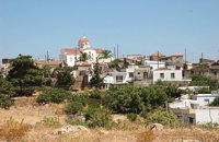 Pediada, Iraklion at 25.4km (E) Evangelismos (GR: Ευαγγελισμός) at 360 m above sea level, with 365 inhabitants, lies to the SW of Kasteli, distant only 5 km from the county town and about 35 km from Heraklion. In earlier years, the village was called Mouktari or Mouchtari and its name figures in a 1381 contract for the buying and selling of grain. The Byzantine church of the Panagia is worth a visit. On August 6th the village celebrates the feast of the Metamorphosis. Evangelismos is the seat of the newly (2010) created municipality, according to the National "Kallikratis Project", by uniting the former municipalities of Kastelli, Thrapsano and Akalochori. The name of the new municipality is "Minoa Pediada"  Messara, Iraklion South at 25.5km (SW) Kamilari is a quiet, traditional village, with a panoramic view to the endless olive groves of the Messara valley on the one side, and to the Libyan sea on the other side. It has been inhabited since the Minoan period. One of the seven wise men of the ancient world, Epimenidis, a great wise man and a soothsayer, lived in a small community outside Kamilari, called Metohi.
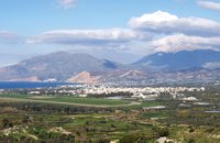 Messara, Iraklion South at 25.6km (W) The town of Timpaki (GR: Τυμπάκι) is located in the west edge of the plain of Messara, 65.3km away from the city of Iraklion. It is a rich and busy town with significant economic activity especially due to the early vegetables production in the wider area. There are banks, a post office, medical centers, stores, schools, hotels, restaurants, ect to cover both the needs of the locals and visitors.
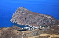 Iraklion South at 25.9km (SW) Léndas or Léntas (GR: Λέντας), positioned almost in the centre of Cretes' south coast, clusters around a pretty bay that's dominated by an enormous rock resembling a lion's head that juts into the sea on one side of the resort. The village offers most facilities you might need during your stay; a choice of tavernas, three or four directly on the beach, two or three bars, mini-markets and even an Internet café. There is a sand/shingle beach and the sea is crystal clear and perfect for snorkeling.
Image Library
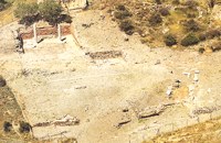 Lentas, South Iraklion at 25.9km (SW) The first habitation of the site dates from the Neolithic and Early Minoan period (3rd millenium B.C.). In the late Classical period (beginning of the 4th century B.C.) the Gortynians established the sanctuary of Asklepios at the harbour. During the tremendous earthquake of 46 B.C. the city was destroyed and subsequently rebuilt. In the Early Christian and Byzantine periods, a small settlement developed and the basilica was erected. The most important monuments of the site are: The Temple of Asklepios., the "Treasury"., the Fountain, a large, three-aisled basilica, an Early Minoan settlement (2600-2000 B.C.), the West Stoa, the North Stoa, the Nymphaion and two large, mud-brick cisterns. 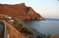 Iraklion South at 26.5km (SW) A long beach west of Lendas on the south shores of Iraklion. The name is probably a corruption of Dysikos (GR: Δυσικός) which is the one to the west. There is a small settlement with taverns and accommodation complexes, mostly rooms and apartments for rent. Dyskos used to be popular with nudists and nature lovers in the past and even in present days nudism is tolerated in the western part of the beach. The beach has small pebbles and sand. Those who chose Dyskos for their holidays will have, among other things, the chance to explore the area by small walking tours and enjoy the magnificent sunset.
Image Library
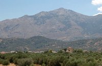 Pediada, Iraklion at 26.8km (E) 330 m above sea level, just out of Kasteli (1.5 km) to the east, lies the village of Archangelos (GR: Αρχάγγελος) with 433 residents. It was founded in 961 by the military forces of Nikiphoros Phocas and was originally named ‘Varvaro’, and was still known by that name in 1583, where the Chandax Register puts it down as a village of the Pediada district with 37 inhabitants. Its name was changed only recently, in 1961, to Archangelos, and the main village church in the square is dedicated to the Archangel Michael. There is another smaller and older church, that of the Panaghia, with Byzantine wall paintings. Remains of ancient mills can still be seen. In a location known as Trochalos, archaeological finds have brought to light a series of Minoan tools dating back to the first and second Late Minoan periods. As in every Cretan village, raki and ‘mezedes’ are always available at the kapheneions. The feast of Michail Archangelos on November 8th is celebrated with much feasting in the village. 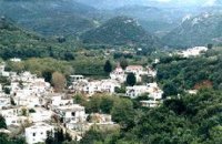 Malevizi, North - West Iraklion at 27.1km (N) A traditional village - birth place of Domenikos Theotokopoulos (EL GRECO) - with many pottery and weaving workshops. Close to the village is a small beach with taverns and a large hotel resort. Fodele is known also for its quality orange production.
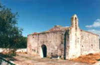 Pediada, Iraklion at 27.1km (E) At an altitude of 380m, with 63 inhabitants, Liliano (GR: Λιλιανό) is first mentioned in the Turkish census of 1671. The Basilica with its three naves, dedicated to Saint John, was built in the 12th -13th centuries and is one of the oldest and the most interesting in Crete. The stones used in its construction came from earlier buildings. The three naves, with the middle nave higher than the other two, are supported by columns in Ionic style. The narthex in front is lower with wider arches, whereas the door and windows have pointed arches. 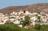 Pediada, Iraklion at 27.1km (NE) The village of Smári (GR: Σμάρι) is a traditional Cretan village, only 10 km away from Kasteli and has 375 inhabitants. In it you will find beautiful old stone houses that have been restored, picturesque little alleys, ruins of older buildings and pottery workshops where you can purchase copies of Byzantine and Minoan ceramics. There are also some interesting churches with wonderful frescoes like the one dedicated to Sotir Christos, the Koimisi tis Panagias and Agios Giorgos. The earliest reference to the village of Smari dates back to 1375. There is a lively Cretan feast on July 20th in honour of Profitis Ilias, with much rejoicing, singing and dancing.  Messara, Iraklion South at 27.2km (SW) The village of Pitsidia is located 65 km southwest of Iraklion at an altitude of 80 m a.s.l, just before the magnificent bay of Messara. The village with aproximately 700 inhabitants is the oldest village of the area and is refered (by S. Spanakis) that it was the place where the soldiers of Nikiforos Fokas, commander of the Byzantine army, settled. The army, famous for its bravery, came from Pisidia of the south Asia Minor, and this is probably the origin of the name Pitsidia.
Image Library
 Amari, Rethymnon at 27.2km (W) The village of Apodoulou is located 55 km from Rethimno at an altitude of 450m. Remains of an extensive centre of the Old Palace period (1950-1700 B.C.) have been uncovered.at the site called Gournes, near the village of Apodoulou, at the west foot of Psiloreitis. The site dominates the Amari valley and controls the main route to the Messara plain. Excavations have brought to light three building complexes while tholos tombs of the Postpalatial period (1380-1200 B.C.) have also been located in the adjacent area. The first excavations on the site were carried out by S. Marinatos in the 1930's. During World War II it was excavated by the German Archaeological Institute, under the direction of E. Kirsten. Since 1985, systematic excavations have been carried out by the Greek Ministry of Culture in collaboration with the University of Naples. The most important monuments on the site are: Building A. It lies on the east side of the hill, to the south of the massive retaining wall. It had two storeys, as is indicated by the two preserved steps of a staircase. Decades of pithoi and other vases found on the ground floor suggest that it was used for storage. The house was destroyed by fire which followed an earthquake. Building B, located to the north of the retaining wall. It is a complex of rooms which originally communicated with Building A. Building C. It lies to the east of house A and belongs to a later phase of the settlement. Tholos tomb at Sopatakia. Tholos tomb with dromos, lying to the east of the road that leads from Apodoulou to Nithavris. The dromos is 7 m. long and the chamber has a diameter of 3.10 m. Three larnakes were found inside the burial chamber. Dated to 1380-1200 B.C. Source: The Hellenic Ministry of Culture 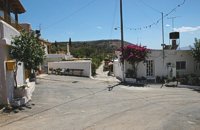 Pediada, Iraklion at 27.2km (E) Village of the area of Kastelli with 115 residents, Agia Paraskevi is situated 5 km northeast of Kastelli at an altitude of 400m. It is first mentioned in the Turkish census of 1671 as Agia Paraskevi tou Xourdou with 17 haratsia (head tax). It is very possible that Santa Venerata, a village mentioned in 1463 by Cardinal Bissarion, is the name by which Agia Paraskevi was known at that period.  Painter born in Fodele, Iraklion at 27.5km (N) Great painter famous as "EL GRECO"(Fodele Iraklion Crete 1541 - Toledo Spain 1614) El Greco's art is the product of both his time and his genius. The artistic currents and the places he visited, are reflected in his work. It is more difficult to outline precisely the influence of the Cretan School in his work. Birth name: Doménikos Theotokópoulos (GR: Δομήνικος Θεοτοκόπουλος) Born :1541 Crete, then Republic of Venice Died :April 7, 1614 Toledo, Spain Field :Painting, sculpture and architecture Movement :Mannerism, Antinaturalism Famous works :El Espolio (1577–1579), The Assumption of the Virgin (1577–1579), The Burial of the Count of Orgaz (1586–1588), View of Toledo (1596–1600), Opening of the Fifth Seal (1608–1614). 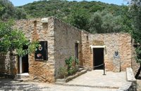 Fodele, Iraklion, Crete at 27.5km (N) The museum is located at a place called "Archontiko", around 1000m west from Fodele village and is housed in the house where according to tradition the great painter Doménikos Theotokópoulos (El Greco), was born. The exhibits are mainly photo - reproductions of his paintings and other documents related to the painter's life and work. The house was severely damaged by the passage of time. The restoration began in 1982 with a grant from the Ministry of Culture and the considerable help of the then Minister Melina Mercouri, in collaboration with the community of Fodele. It was reconstructed according to its original design. 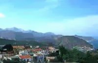 Malevizi, North - West Iraklion at 27.8km (N) Ahláda (GR: Αχλάδα) is a small village located 24 kms west of Iraklion at an altitude of 300 meters a.s.l. It is close to the tourist resorts of Agia Pelagia and Ligaria, and it has approximately 500 inhabitants, most of them farmers and stock breeders. The name of the village meaning wild pear tree is given probably due to the huge wild pear tree that used to be at the village. 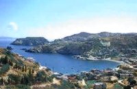 Agia Pelagia, Maleviziou, Iraklion N-W at 28km (N) Lygaria (also Ligaria GR: Λυγαριά) is a small seaside resort 2 kms to the east of Agia Pelagia. It is built in a small cove with a lovely sandy beach protected from the summer winds (Meltemi). Lygaria started as a residential area comprising of summer houses built mainly by residents of Heraklion but soon it has developed to a tourist resort. It has a couple of small taverns, hotels and cafes by the beach and it is very popular with tourists and locals alike. There is regular public bus transport from Heraklion. The distance from Heraklion is 19 kilometers via the national road.
Image Library
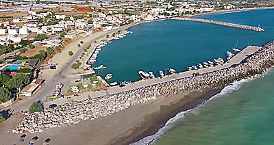 Messara bay, Iraklion South at 28km (W) Kokkinos Pirgos (GR: Κόκκινος Πύργος) is a small coastal community, 2km away from Timbaki with a nice, long sandy beach, one of the longest in Crete, and a clear transparent sea. The part of the beach to the north west of the harbour is called Makrimaliana (or Kakoskalo) and the south east part of it is called Katalyki . The harbour in front of the village of Kokkinos Pirgos, offers docking facilities for sailing and fishing boats. There are hotels, restaurants, bars, etc. across the harbour and along the beach. You can always find good fresh fish in the taverns of the village. Kokkinos Pirgos (meaning red tower) , took its name from a castle that use to be there during the Middle Ages, which was built by red clay earth.
Image Library
|
||
|
| ||
C
O
N
T
E
N
T
S
O
N
T
E
N
T
S


