interkriti®
YOUR GATEWAY TO CRETE
HOME
CRETE FACTS
NAVIGATE
EXPLORE

Agia Galini
Triopetra
Kissamos
Chryssi Isl.
Agia Marina
Balos
Gavdos isl.
Georgioupolis
SAMARIA
IDA Mtn
Palaiochora
Agia Roumeli
Sfakaki
Bali
Kalamaki
Matala
Lassithi
Plateau Lendas
Tsoutsouros
Vianos
Myrtos
Sfakia
Plakias
Ierapetra
Makrygialos
ZAKROS
Vai
Sitia
Agios Nikolaos
Elounda
MALIA
Hersonissos
Gouves
Chania
Rethymnon
Heraklion
GORTYN
FESTOS
KNOSSOS
|
|
Crete
List Grid Map
Found
167
- Showing :
141 - 160
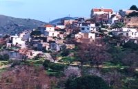
 Pediada, Iraklion at 26.3km (SE) Kastelli (GR: Καστέλλι) is a small town in the countryside of the province of Pediada. It has over 2000 inhabitants and provides all the modern facilities and public services its residents and/or visitors may need. Many events are organized through the year by the municipality, the school and the cultural centre. In August a special festival, known as the Feast of Xenitemenou (ex-patriot feast) includes concerts, folklore, exhibitions and theatre plays.
 Pediada, Iraklion at 26.5km (E) Bizariano (GR: Μπιτζαριανό) is a traditional small village of about 24 inhabitants in the area of Kasteli Pediada, 320 m above sea level and about 3 km to the north of Kasteli on the road to Hersonissos. A pretty village with stone houses, graphic lanes and courtyards covered in flowers. It is first mentioned in 1881, as Bizariano, Municipality of Kasteli, with 55 Christian inhabitants. In 1951, it changes its name to Pigi. Its first name is that of a family, Bizariano. Close to the village, in a beautiful spot full of lush vegetation, evergreen plane trees and gushing water, stands the ancient church of Agios Pandeleimonas, with its three naves. Two rows of arches supported by columns without capitals separate the naves. Another column is made exclusively of capitals, apparently brought in from other churches or temples. Practically all the middle outside wall is decorated with inscriptions, Byzantine reliefs and crosses. Agios Panteleimon (External) Agios Panteleimon (External) Agios Panteleimon (interior) The artistic highlight of the church of Saint Panteleimon are its fresco scenes painted on the walls which are among the oldest in Crete, although very few frescoes remain. In the lower section of the arch, there is the representation of the three Hierarchs, shown on full length, with vertical inscriptions on it. On the two side walls there are the representations of Saints in a colossal size. These scenes were designed to be a source of biblical education to the faithful, who would have been illiterate at that time. Image Library
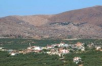 Pediada, Iraklion at 26.7km (SE) Polythéa (GR: Πολυθέα) is located 500 m NE of Kastelli at an altitude of 335m.N Nowadays Polythea has become part of Kasteli and it has 364 inhabitants. Fr. Barozzi mentions it as Apigaiduri in 1577, belonging to the Pediada district and it continues to be known with that name until 1940, when it is re-baptized with its current name, Polythea. The previous name of the village, Pigaidouri, is originated by the word ‘pigaidi', which is Cretan for ‘pigadi', which means ‘a well'. It is a nice name that propably has been changed due to the fact that people thought it was a reference to ‘gaidouri', which means ‘donkey'. Apart from the ubiquitous raki and mezedes served at the kapheneions, you can also find rooms for rent. A typical Cretan feast is held here on August 15th for the Virgin Mary (Assumption). 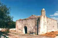 Pediada, Iraklion at 26.9km (SE) At an altitude of 380m, with 63 inhabitants, Liliano (GR: Λιλιανό) is first mentioned in the Turkish census of 1671. The Basilica with its three naves, dedicated to Saint John, was built in the 12th -13th centuries and is one of the oldest and the most interesting in Crete. The stones used in its construction came from earlier buildings. The three naves, with the middle nave higher than the other two, are supported by columns in Ionic style. The narthex in front is lower with wider arches, whereas the door and windows have pointed arches. 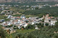 Pediada, Iraklion at 27.1km (SE) Diavaide (GR: Διαβαϊδέ) has 120 inhabitants and lies very near to Kasteli (700m to the SE) at 355m above sea level. The earliest reference to the name is found in the Ducal Archives at Chandax in 1378. Another document in the same archives mentions a certain G. Dochiano, inhabitant of Diavaide. In an inscription, found in the Byzantine church of Agios Georgios Sfakiotis, the name of the village is clearly mentioned, indicating that Diavaide existed well before the Turkish occupation. In that church there is a unique fresco of Byzantine art that represents Saint George and Saint Demeter passing through the sea on their horses, while at their feet lie various sea creatures; crabs, lobsters, and other fish, a strange phenomenon indeed, considering that the village is so far away from the sea. There is also the church of Agios Nikolaos in the village dated to the same period. The village took part in all the main fights by Crete against the enemies of its freedom, while during German occupation the high college of Kastelli continued to operate in Diavaide houses. The cultural association of the village, one of the first in this area, strives to maintain the cultural traditions and the continuity of village history through the years. 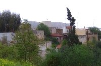 Pediada, Iraklion at 27.2km (E) Anbother beautiful small settlement, with 38 people, Kato Karouziana (GR: Κάτω Καρουζανά) lies at an altitude of 300m and is located at 49km from Herakleion and 1km from Epano Karouzana. It offers a spectacular view to the Kastelli plain, picturesque paved lanes, traditional kafeneia and taverns and is a popular with tourists, especially in the summer when many Cretan evenings are organized with local music and dance. 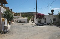 Pediada, Iraklion at 27.9km (SE) Village of the area of Kastelli with 115 residents, Agia Paraskevi is situated 5 km northeast of Kastelli at an altitude of 400m. It is first mentioned in the Turkish census of 1671 as Agia Paraskevi tou Xourdou with 17 haratsia (head tax). It is very possible that Santa Venerata, a village mentioned in 1463 by Cardinal Bissarion, is the name by which Agia Paraskevi was known at that period. 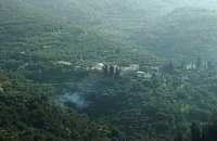 Pediada, Iraklion at 28km (E) A beautiful small settlement, with 48 people, Epano Karouziana (GR: Επάνω Καρουζανά) lies at an altitude of 380m and is located at 40km from Herakleion. It is mentioned for the first time in 1842, its name was taken by a family name "Karouzos" common in the village. The village offers a spectacular view, picturesque paved lanes, traditional kafeneia and taverns and is a popular with tourists, especially in the summer when many Cretan evenings are organized with local music and dance. 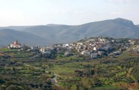 Pediada, Iraklion at 28.3km (SE) Built at 510 m with 319 people Ksidás (GR: Ξυδάς) also known as Lyttos, is located at 3 km from Kastelli in the foothills of the site of the ancient town Lyttos. The first mention of the village goes back to 1368AD, with the name Ksidas. A burial site was discovered when the road was being constructed, at Chomatolakkos, belonging to late Roman period. Two gold rings have also been found here, the one with stone, showing the portrait of an emperor holding a spear, and the other with a hoop, showing two interlocking hands. A bronze ring with a Greek inscription, along with golden plates and bronze coins, were also found at this site. Image Library
 by Richard Ellis at 28.6km (W) This is my log of the E4 long distance walk along the spine of Crete from East to West - it is intended to be a useful resource for others who are contemplating a similar walk along the E4 in Crete; it is not intended in any way to be a complete route guide.
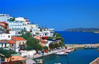 Rethymnon North coast at 28.8km (NW) Bali is a small fishing village, about 40 km west of Iraklion and 37km east of Rethymno easily accessed from the international road. It has a small picturesque harbour and lots of small coves with wonderful clear beaches. Recent years Bali has been developed to a popular tourist resort but it is still preserves its traditional character. Ideal place for family holidays, with small hotels and lovely taverns serving fresh fish and local specialties. 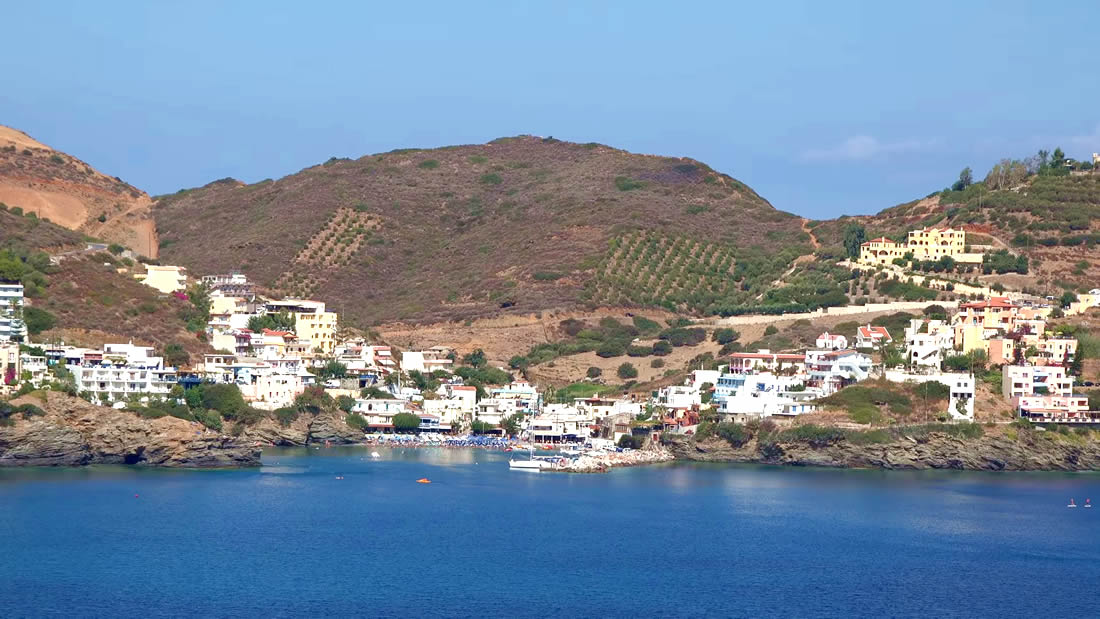 The Venetians called the place "Atali", from its ancient name which was "Astali", while its current name was given by the Ottomans. There is also the Atali Monastery nearby, which retains the medieval name of the place and is dedicated to Saint John. The monastery is built on a small elevated peninsula overlooking the bay and the Cretan sea. Image Library
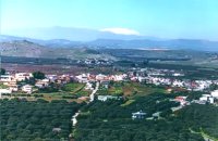
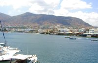 Pediada, North - East Iraklion at 28.9km (E) The most popular tourist resort in Crete. Nice beaches, sights and facilities for all tastes and ages. Together with Malia, are the party places for young visitors. Close to Hersonissos there are three small traditional village, those of Piskopiano, Koutouloufari and Old Hersonissos.
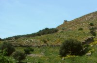
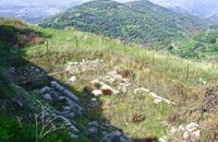 Kasteli, Pediados at 28.9km (E) The ancient city of Lyktos or Lyttos (GR: Λύκτος / Λύττος) was one of the most ancient and powerful towns in Crete. Although the excavations in the area reveal traces of habitation from the Hellenistic years onwards (630 B.C.), the archeologists Georgios Rethemiotakis and Angeliki Lempesi have excavated traces of habitation from the time of the destruction of Lyttos by the Knossians (219 B.C.) in excavated residences of the Hellenistic period. From the Roman period, the city was subject to new workings as testified by the architectural remnants and the many inscriptions and statues discovered. Numerous vestiges of ancient structures, objects, and broken marbles are seen, as well as an immense arch of a Roman aqueduct, by which the water was carried across a deep valley by means of a wide marble channel. Traces of the aqueduct which brought its water supply from Kournia, near Krasi village, are still visible today in the rural road to Kastamonitsa village. Lyktos had also a theatre, built in the slope of the hill the design of which we know only from the drawings of Belli (1586). Finally, the most important discovery is that of a room of nearly 14 metres by 11.40 metres, with marble flooring and a series of four stone platforms along its two longer sides. The room was erected, according to the inscription that was found at the site, at the beginning of the second century B.C. This room was identified as the chamber of the Roman deputies of the city and was very probably destroyed by an earthquake at 365 AD. Lyktos appears to have still been inhabited in the 7th Century AD as indicated by the excavation of late-roman shops in the area. (Late Roman Empire, 284-610 AD) 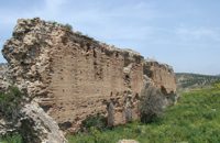 Gortyn archaeological site at 29km (SW) The main acropolis of Gortyna was located on Agios Ioannis hill, to the northwest of the Agora. Acropolis can be accessed from its west side driving through Ambelouzos village to the direction of Gergeri. At a spot around 1.6 kms from Gortyna parking there is a footpath (not clearly signposted and maintained) that leads to the top of the hill. Once at the top you'll be rewarded by the magnificent view to the whole area and the archaeological site itself. The site was first inhabited in the Neolithic era and again at the end of Minoan times (1200 BC). Since then it was continuously inhabited until the Middle Byzantine period. From the first settlement only parts of walls, floors and hearths were preserved. In the 10th century BC a Geometric settlement was established fortified by a polygonal wall with towers at the corners. At the end of the 7th c. A.D., a small tripartite temple, dedicated to Athena Poliouchos was founded at the south side of the hill. From this temple some very important architectural sculptures were excavated. During the Early Byzantine period (5 - 6th century AD), a basilica was erected over the ruins of the geometric/archaic temple and, in the time of the emperor Heraclios (7th century A.D.) the last fortification with a castle in the center was built which still survives but in a very poor condition. Image Library
 Messara, Iraklion South at 29.1km (S) Agioi Déka (GR: Αγιοι Δέκα) is a town with 820 inhabitants in the plain of Messara, 170m above sea level, 43 km from Heraklion town and very close to the archaeological site of Gortyna. Its people are occupied mostly in agriculture - vines and olive trees. In the area there is is the oldest olive grove in Crete. The town is built on the ruins of the ancient town of Gortyn where the Holy Ten Martyrs have been martyred. 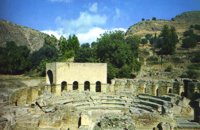 Gortyn archaeological site at 29.1km (SW) The Roman Odeum at Gortyn is considered one of the best and the most important of its type on Crete. Is has been founded at the North part of the Ancient Agora of the City. This semicircular building consists of three main parts: a. The Cavea, connected with a domed corridor through three wide staircases; b. the Orchestra, which has an internal diameter 8,5 m. and was paved with white and blue marble slabs; c. The Scene, which had two entrances and the paraskenion, with mosaic pavement in geometric pattern. Statues of Muses stood in the niches. Initially the building was a circular Ekklesiasterion founded in the 5th c. BC. In the portico of this public building the Great Inscription with the Law Code of Gortyn dated to the early 5th c., stood. It was destroyed twice: in the 1st century BC, and again in 46 AD. After this last destruction it was reconstructed as an Odeum. The great Inscription is considered to be the largest Greek inscription, the Queen of all Inscriptions. Its first fragments were found by the French travelers and were bought by the Louvre Museum. The most part of the Inscription was found accidentally by local farmers in 1884 and was further explored F. Halbherr. It is a Law Code inscribed in the boustrophedon system of writing. It dates in the 1st half of the 5th c. BC and is the oldest Greek and European Law Code. It consists of twelve Deltoi and was built in the Ekklesiasterion of the 5th c BC. In this Code older laws, regarding the personal and family rights of the citizens of Gortyn, were codified. Image Library
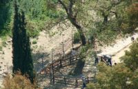 Gortyn archaeological site at 29.1km (SW) According to the myth, Zeus, disguised as a bull, coupled with Europe, whom he had brought from Phoenicia, under a deep- shaded plane tree on the banks of the Lethaios River. The offspring of this union were three sons, Minos, Sarpidon and Radamanthis. Later, the oldest Agora of the city of Gortyn, the Ekklesisterion (Congress hall), and the Roman Odeum were founded on this site. The plane tree was blessed and has remained ever green since that time. As his place of birth, the city was founded by King Minos himelf. According to the myth, it was on the fields of Gortyn that the bull given as a gift to Minos by Poseidon coupled with the Queen Pasiphae and out of this union Minotaur was born. Image Library
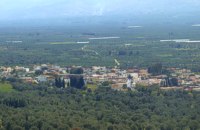
 Gortyn archaeological site at 29.1km (SW) The oldest theater of Gortyna was on the south slope of the Profitis Ilias hill (Acropolis), opposite to the Odeum. Its cavea was partly cut into the rock and partly built. Its scene was built at the west side of the large court of the Agora, which covered the river Lethaios with a flat bridge. This scene, which H. Belli saw in the 16th c AD, was 120 m long and was already destroyed in 19th c. AD. On the proscenium there was an inscription of Julia Augusta and it was decorated with statues and relies, among which there was the statue of Europe on the Bull, with broken legs and head.This statue, as described by Admiral Spratt, is now kept in the British Museum and is dated to the 2nd c BC. 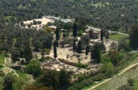 Messara, Iraklion South at 29.2km (SW) Located in the valley of Messara, Gortys or Gortyn (GR: Γόρτυς or Γόρτυνα) is a must visit for all visitors to Crete. It was inhabited during Bronze Age times, but its rise to glory came almost a millennium after the downfall of the 'Minoans'. Gortyn was a prosperous city from around the middle of the 5th century BC through to the early 9th century AD, when it was finally destroyed by the Saracens (824AD), never to be rebuilt.
Image Library
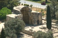 Gortyn archaeological site at 29.2km (SW) Saint Titus church at Gortyn bears the name of the Apostle Titus, attendant of Apostle Paul, who was appointed as the first Christian bishop of Crete. It is one of the most important Byzantine monuments in Crete. The name was given to the ruined church by the excavators in the beginning of the 20th c., as they considered it to be the site of the saint’s martyrdom. After the discovery of the new Great Early Byzantine Basilica, just outside the village Mitropolis, its excavators have proposed that as the original bishopric basilica, as it is a century earlier than this, which in the local tradition is named and celebrated after Virgin Mary, “Kera”. The church has the plan of a three aisled inscribed cross with a low vault. It has been built of ashlar limestone. It has a narthex to the west and five entrances three of which form the trivelum with two columns. There were pillars instead of columns. Its architectural features date its foundation in the 2nd half of the 6th c. AD. Image Library
|
||
|
| ||


)
)
)
C
O
N
T
E
N
T
S
O
N
T
E
N
T
S