interkriti®
YOUR GATEWAY TO CRETE
HOME
CRETE FACTS
NAVIGATE
EXPLORE

Agia Galini
Triopetra
Kissamos
Chryssi Isl.
Agia Marina
Balos
Gavdos isl.
Georgioupolis
SAMARIA
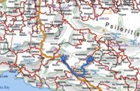
IDA Mtn
Palaiochora
Agia Roumeli
Sfakaki
Bali
Kalamaki
Matala
Lassithi
Plateau Lendas
Tsoutsouros
Vianos
Myrtos
Sfakia
Plakias
Ierapetra
Makrygialos
ZAKROS
Vai
Sitia
Agios Nikolaos
Elounda
MALIA
Hersonissos
Gouves
Chania
Rethymnon
Heraklion
GORTYN
FESTOS
KNOSSOS
|
|
Crete
List Grid Map
Found
206
- Showing :
21 - 40
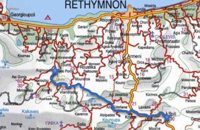
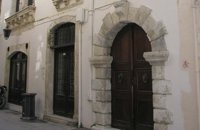 Rethymnon Old Town at 12.1km (W) The Museum of Submarine Life is situated at Arapatzoglou street, at the center of Rethymno's old city. It was founded by the "Moshaki" family, in memory of their lost child, who drowned in the sea. The largest part of the exhibits are made up of shells, while a few vertebrates, sponges and fish are also on display.
 Rethymnon city at 12.2km (W) The Institute for Mediterranean Studies (IMS) based in Rethymno, Crete, was founded in 1985 and belongs to the research units of the Foundation for Research and Technology, Hellas (FORTH). The IMS is the only FORTH centre which deals with the human and social sciences. The purpose of IMS is to support and invigorate research in the field of the human and social sciences, as well as to promote the application of advanced technologies in the field. The IMS possesses a fully equipped Laboratory of Geophysical-Satellite Remote Sensing (GIS) & Archaeo-environment, specialized in archaeological research. The Library of the Institute is focused on Turkish Studies and Art History. In the Library archival material, as well as collections of Greek and foreign newspapers in digital form and microfilms are kept. The objective of the IMS's research programs is to study the geographical space, the history and culture of Greece and the other Mediterranean countries in various historical periods, from prehistory to modern times. In order to achieve these objectives, the research projects of the Institute are organized along the following axes: Turkish Studies History Studies Art History History of the Theatre - Ethnomusicology The Laboratory of Geophysical-Satellite Remote Sensing & Archaeo-environment Its activities concern the field of geophysical research, the satellite remote sensing, the Geo-information technologies and the archaeo-environment, with emphasis on the Mediterranean region. The Laboratory is a member of international organisations such as EPOCH, EARSel. and AGILE and participates in a number of joint research and technology programs in Greece and abroad (e-Content, INTERREG, ARCHIMED, ETPA, PEWNED, EPEAEK, INSTAP, LIFE, Region of Crete). The research programs of the Institute are carried out by its permanent researchers and collaborating faculty members. In the frame of these research programs are prepared PhD Thesis and other diplomas which are submitted to the higher educational institutions with which IMS collaborates and, particularly, to the University of Crete, the Technical University of Crete and the Technological Educational Institute of Crete. The IMS supports education at post-graduate and post-doctoral level with a considerable number of annual scholarships, thus contributing to attract a steady flow of young researchers and to promote research in the field of humanities at the periphery. The IMS maintains close academic links with various international research foundations (Cyprus, Turkey, Bulgaria, Italy, France, Spain, England, Belgium, Tunesia, Egypt, China, USA, a.o.). The IMS is administered by a director and a five member academic council (A.C.). It is housed in wholly-owned premises comprising of two listed buildings in the old town of Rethymno. The core of one edifice dates back to the Venetian period (13th - 17th century). Links: www.ims.forth.gr/ 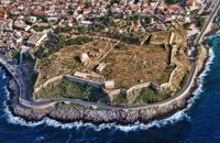 Rethymnon town at 12.3km (W) The Fortezza castle, at the top of a low hill named "Palaiokastro" dominates the town. It was built in 1590 to protect the city from the pirates raids and the Turks. The name "Palaiokastro which means 'The old Castle' was in use even by the Venetians which demonstrates the existance of an even older castle at this place. - Probably the acropolis of the ancient town of Rithymna. The interior of Fortezza accommodated the following basic buildings: the storeroom of the artillery, where canons and weapons were kept, the residence of the Councilors, where one of the city's two Venetian councilors lived, the residence of the Rector, which represented a luxurious, magnificent building in the central square of the fortress. Today parts of those buildings, as well as of some others built later, can be seen. The view from up there is magnificent, especially at night. The municipal theatre "Erofili" stands also at Fortezza's premises. It is an outdoor theatre that hosts almost all the performances during the Renaissance Festival. Image Library
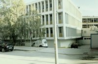 Rethymnon city at 12.4km (W) Rethymnon General Hospital is situated at 17, Trandalidou Str., close to the municipal gardens. The hospital has all major clinical specialties, outpatient clinics, intensive care unit and generally offers sufficient medical services throughout the prefecture of Rethymnon. 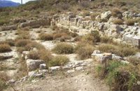 Amari, Rethymnon at 15km (S) Sivritos (GR: Σίβρυτος) was an important and autonomous city of the ancient Crete. The city was built in the location that today is the village of Thronos. It was located on a hill dominating the valley of Amari. The name Sivritos is derived from the words si, that in the ancient eastern languages meant water, and the word vriti, that is of prehistoric origin and meant sweet. Therefore, Sivritos in the Minoan period meant sweet water. The derivation is also verified by the fact that near the hill where the city was located there are numerous sweet water springs. 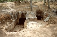 Armenoi, Rethymnon at 15.1km (SW) The site was first discovered by a teacher who noticed that two pupils were playing football using a minoan vase as a ball!. He mentioned the fact to the authorities and the excavations that followed unearthed about 300 tombs of the Late Minoan III period (1450-1100 BC). As the tombs had not been yet looted, the archaeologists found significant treasures like vases, weapons, statuettes, jewels etc. It is obvious that such a big cemetery should belong to a big city which, despite the extended investigations of the archaeologists, has not been discovered yet. Image Library
 Gonia, Rethymno at 16.2km (W) The Municipality of Nikiforos Fokas is located in the north of Rethymnon Prefecture. The area is known for its outstanding natural beauty and its historical tradition and architecture. All of the municipality's settlements are steeped in history and contain fine examples of architecture, featuring stone buildings with vaulted entrances (known as "diavatika") and magnificent thresholds. The municipality's jurisdiction extends over the fourteen former community wards of Agios Konstantinos, Ano Valsamonero, Atsipopoulo, Gerani, Gonia (Athanatos), Zouridi, Kalonyktis, Kato Valsamonero, Malaki, Mountros, Prines, Roustika, Saitoures and Frantzeskiana Metochia, which comprise a total of 21 villages. 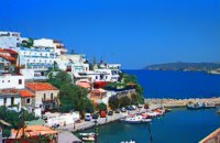 Rethymnon North coast at 16.3km (E) Bali is a small fishing village, about 40 km west of Iraklion and 37km east of Rethymno easily accessed from the international road. It has a small picturesque harbour and lots of small coves with wonderful clear beaches. Recent years Bali has been developed to a popular tourist resort but it is still preserves its traditional character. Ideal place for family holidays, with small hotels and lovely taverns serving fresh fish and local specialties. 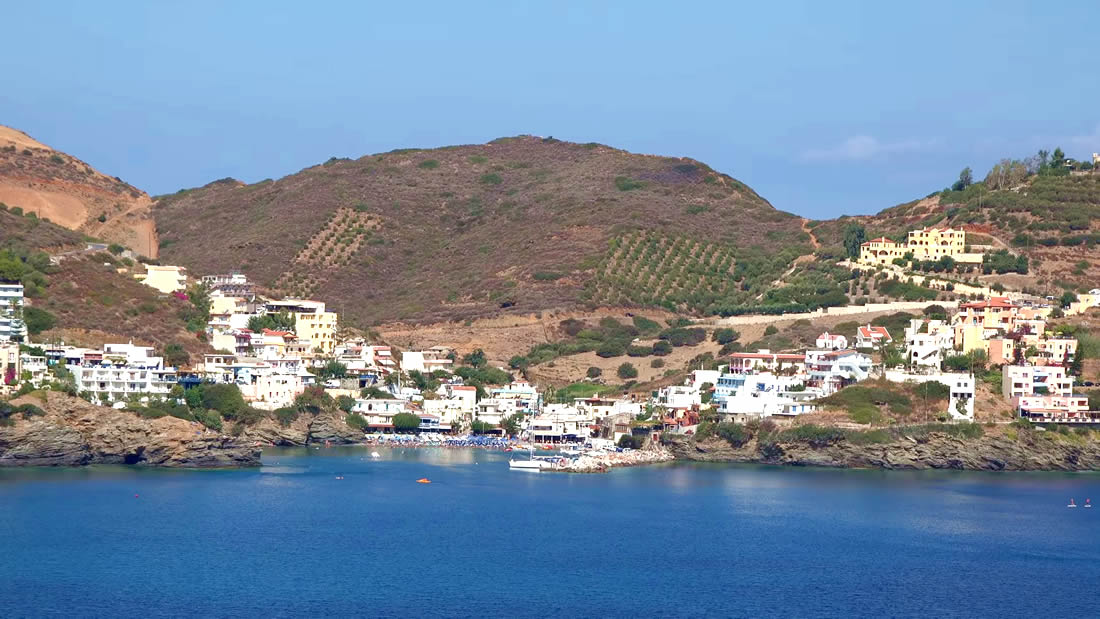 The Venetians called the place "Atali", from its ancient name which was "Astali", while its current name was given by the Ottomans. There is also the Atali Monastery nearby, which retains the medieval name of the place and is dedicated to Saint John. The monastery is built on a small elevated peninsula overlooking the bay and the Cretan sea. Image Library
Monastiraki (The archaeological site) Amari at 18.7km (S) Monastiraki lies in the valley of Amari, on the natural route leading from northern Crete to the Messara plain. Excavations have brought to light a centre of the Old Palace period (1950-1700 B.C.). which was destroyed by fire following an earthquake. The large number of storerooms and the existence of two archive rooms with many clay sealings indicate a palatial character for the site. Other finds on the top of a neighbouring hill suggest there must have been a religious centre in the area, as well. Image Library
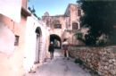
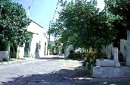
 by Richard Ellis at 19.5km (S) 26th August - You get to see Kedros close up and enjoy fabulous views back over the Amari Valley to Psiloritis and forwards over the high, little-visited plain above Spili. Once off dirt roads, the path is generally pretty clear on the ground but as ever the GPS helped me not to stray too far. As you come up out of Yerakari on the Spili road (a tempting ten kms) you take a left just after a fresh water fountain and immediately by a large cistern. There are many distracting side roads along here but you stay with the main dirt track as it winds close under Kedros before turning west. Distance:20km Mov av 4.6 km/hr Height overnight: 402m. Max. height:1,050 m Start at 680m 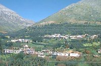 Mylopotamos, Rethymno at 19.7km (E) Apladianá (GR: Απλαδιανά) is a small village built at the foot of the two Kouloukona heights. The settlement stretches out along the old national road, where it developed after the opening of the new national road. It comprises cafes, tavernas, and accommodation facilities included in the Countryside Tourism programs. It is worth your while, however, to visit the old village, climbing there on foot or by car. Picturesque, narrow streets, wonderful old houses with interesting architectural elements, old cisterns and churches will reward your efforts. The old village built on a height of 260 m above sea-level has 175 inhabitants and the settlement along the old national road, known as "Kampos ton Apladianon", has 78 inhabitants. It is 40 kilometres away from Rethymnon and is located at the foot of the highest peak of the Kouloukona mountain in the Tallaios range. Historical background Already as far back as 1368 we find a mention of the Aplada family, the founders of the present village and in the topographical maps of the Civil Engineering Services of Rethymnon it figures as Pladiana. The settlement is not mentioned in the 16th and 17th cent. documents. In the 1881 census, Apladiana is attributed to the commune of Garazo, with 57 inhabitants and in 1900 it is referred to as the Apladiana Commune which, together with the Cheliana settlement, had 153 inhabitants. 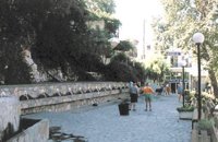 Spili, Rethymno at 20km (S) Spili (GR:Σπήλι) is 30 km away from Rethymnon, along the road that goes from Rethymnon to Armenoi and then Spili. The town has about 800 inhabitants and it lies at a height of 430 m above sea level, at the foothills of Mount Vorizi, which belongs to the Kedros chain. The landmark of the town is the square at Kefalovrissi with the 25 fountains each one in the shape of a lion's head. The square is named after Thanassis Skordalos (1920-1998), a popular lyra player and composer born in Spili. Spili is a modern town, with all the facilities and services required by the locals and by the large number of visitors. Image Library
 by Richard Ellis at 20.1km (S) 27th August - I set off from Spili at 0740 under a rather cloudy sky and with a cooling breeze to keep me feeling fresh. Today was always going to be a bit of a road slog and the first few kms to Mixourama was on the main road with cars flashing by. The GPS suggested that there was a road link between Koxare and Agouseliana even though there was nothing on the paper map so, after 6 or 7 kms, I cut across to Koxare. Distance: 32 km Time: 8 hrs. 25mins. Mov av 4.8 km/hr Height overnight: 272m. 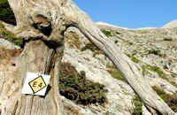 by Richard Ellis at 23.6km (SE) This is my log of the E4 long distance walk along the spine of Crete from East to West - it is intended to be a useful resource for others who are contemplating a similar walk along the E4 in Crete; it is not intended in any way to be a complete route guide.
 Rethymnon at 23.9km (SW) The village stands 17km away from Rethymno and 6km from Episkopi. It has 160 inhabitants, farmers and stock breeders. The first university of Crete, called VIVI'S ACADEMY operated here in 1540 AD. There are remnands of many Venetian Houses, such as Villa Barocci, a mint, a fountain etc.
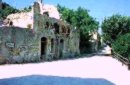 Rethymnon at 24.9km (SW) Zouridi is a village of the county of Rethymno, located 19,5 km away from the city, built at 260m a.s.l. with 90 inhabitants. Here excavations unearthed findings from the post palace period, and the Roman period as well as many venetian houses. Nowadays the village is characterized as a preservable settlement, and buildings such as the old high school are going to be restored.
 Rethymnon North at 25.3km (W) Episkopi is a small town of the prefecture and county of Rethymno. It is located at the old national road of Rethymno - Hania, 17 km away from the city of Rethymno. The town is built at 120 m a.s.l. overlooking the northern coast of Crete, and the green and fertile valley of Mousselas river.
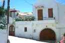
 Kanevos, Agios Vasslios at 25.8km (SW) At the beautiful small village of Kanevos on the road from Rethimno to Plakias, a little before the imposing gorge of Kotsifos you will find Iliomanolis tavern. Mrs Maria an experienced cook, will offer you her best specialties made with fresh pure Cretan products, and your lunch, breakfast or dinner will be one of the most pleasant experiences in Crete.  Rethymnon North at 27.1km (SW) A beautiful small town in the county of Rethymno with great views, natural water springs and lush vegetation. It's located at 260m a.s.l. between the rivers "Mousselas" and "Petres", 22km from the national road and 5km from Episkopi. Argiroupolis is the site of the ancient city of Lapa.
 by Richard Ellis at 27.1km (SW) 28th August - Because we had researched this bit in May, it wasn't so daunting to leave the tarmac-bound E4 and to launch off uphill to make the old crossing (not yet on any map) between here and Askyfou. The first gully climb up to 3,300 ft was quite straight forward as we had done it before. Distance: 22.4 km Time: 8 hrs. 35mins. Mov av 3.7 km/hr Height overnight: 714m. |
||
|
| ||


C
O
N
T
E
N
T
S
O
N
T
E
N
T
S