interkriti®
YOUR GATEWAY TO CRETE
HOME
CRETE FACTS
NAVIGATE
EXPLORE

Agia Galini
Triopetra
Kissamos
Chryssi Isl.
Agia Marina
Balos
Gavdos isl.
Georgioupolis
SAMARIA
IDA Mtn
Palaiochora
Agia Roumeli
Sfakaki
Bali
Kalamaki
Matala
Lassithi
Plateau Lendas
Tsoutsouros
Vianos
Myrtos
Sfakia
Plakias
Ierapetra
Makrygialos
ZAKROS
Vai
Sitia
Agios Nikolaos
Elounda
MALIA
Hersonissos
Gouves
Chania
Rethymnon
Heraklion
GORTYN
FESTOS
KNOSSOS
|
|
Crete
: Regional Interest
List Grid Map
Found
87
- Showing :
81 - 87
 Pediada, Iraklion at 28.3km (SE) Built at 510 m with 319 people Ksidás (GR: Ξυδάς) also known as Lyttos, is located at 3 km from Kastelli in the foothills of the site of the ancient town Lyttos. The first mention of the village goes back to 1368AD, with the name Ksidas. A burial site was discovered when the road was being constructed, at Chomatolakkos, belonging to late Roman period. Two gold rings have also been found here, the one with stone, showing the portrait of an emperor holding a spear, and the other with a hoop, showing two interlocking hands. A bronze ring with a Greek inscription, along with golden plates and bronze coins, were also found at this site. Image Library
 Rethymnon North coast at 28.8km (NW) Bali is a small fishing village, about 40 km west of Iraklion and 37km east of Rethymno easily accessed from the international road. It has a small picturesque harbour and lots of small coves with wonderful clear beaches. Recent years Bali has been developed to a popular tourist resort but it is still preserves its traditional character. Ideal place for family holidays, with small hotels and lovely taverns serving fresh fish and local specialties. 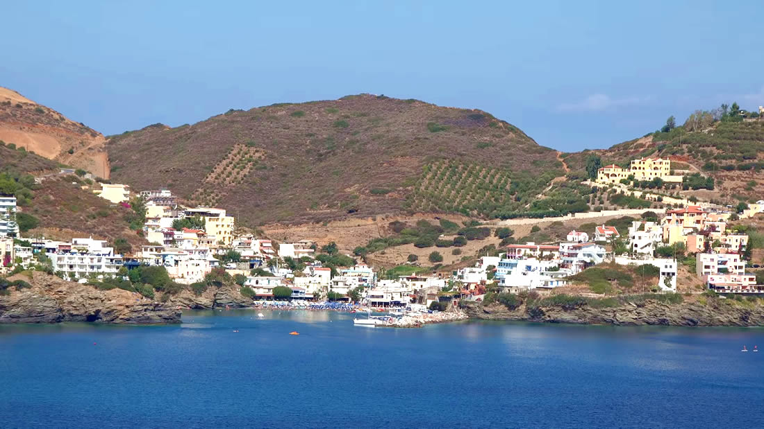 The Venetians called the place "Atali", from its ancient name which was "Astali", while its current name was given by the Ottomans. There is also the Atali Monastery nearby, which retains the medieval name of the place and is dedicated to Saint John. The monastery is built on a small elevated peninsula overlooking the bay and the Cretan sea. Image Library
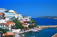
 Pediada, North - East Iraklion at 28.9km (E) The most popular tourist resort in Crete. Nice beaches, sights and facilities for all tastes and ages. Together with Malia, are the party places for young visitors. Close to Hersonissos there are three small traditional village, those of Piskopiano, Koutouloufari and Old Hersonissos.
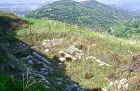 Kasteli, Pediados at 28.9km (E) The ancient city of Lyktos or Lyttos (GR: Λύκτος / Λύττος) was one of the most ancient and powerful towns in Crete. Although the excavations in the area reveal traces of habitation from the Hellenistic years onwards (630 B.C.), the archeologists Georgios Rethemiotakis and Angeliki Lempesi have excavated traces of habitation from the time of the destruction of Lyttos by the Knossians (219 B.C.) in excavated residences of the Hellenistic period. From the Roman period, the city was subject to new workings as testified by the architectural remnants and the many inscriptions and statues discovered. Numerous vestiges of ancient structures, objects, and broken marbles are seen, as well as an immense arch of a Roman aqueduct, by which the water was carried across a deep valley by means of a wide marble channel. Traces of the aqueduct which brought its water supply from Kournia, near Krasi village, are still visible today in the rural road to Kastamonitsa village. Lyktos had also a theatre, built in the slope of the hill the design of which we know only from the drawings of Belli (1586). Finally, the most important discovery is that of a room of nearly 14 metres by 11.40 metres, with marble flooring and a series of four stone platforms along its two longer sides. The room was erected, according to the inscription that was found at the site, at the beginning of the second century B.C. This room was identified as the chamber of the Roman deputies of the city and was very probably destroyed by an earthquake at 365 AD. Lyktos appears to have still been inhabited in the 7th Century AD as indicated by the excavation of late-roman shops in the area. (Late Roman Empire, 284-610 AD) 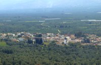 Messara, Iraklion South at 29.1km (S) Agioi Déka (GR: Αγιοι Δέκα) is a town with 820 inhabitants in the plain of Messara, 170m above sea level, 43 km from Heraklion town and very close to the archaeological site of Gortyna. Its people are occupied mostly in agriculture - vines and olive trees. In the area there is is the oldest olive grove in Crete. The town is built on the ruins of the ancient town of Gortyn where the Holy Ten Martyrs have been martyred. 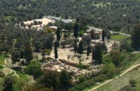 Messara, Iraklion South at 29.2km (SW) Located in the valley of Messara, Gortys or Gortyn (GR: Γόρτυς or Γόρτυνα) is a must visit for all visitors to Crete. It was inhabited during Bronze Age times, but its rise to glory came almost a millennium after the downfall of the 'Minoans'. Gortyn was a prosperous city from around the middle of the 5th century BC through to the early 9th century AD, when it was finally destroyed by the Saracens (824AD), never to be rebuilt.
Image Library
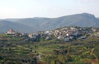
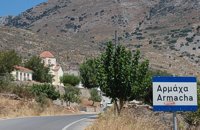 Pediada, Iraklion at 29.7km (SE) Armacha (GR: Αρμάχα) lies at 490 m above sea level, at a distance of 7km from Kastelli, with 110 residents (census 2001) and is first referred to by Barozzi in 1577. Armacha is rich in the production of agricultural and livestock products. The Metropolitan Bishop, Tirnovos Voulgaria Ilarionas Kabanaris Sinitis was born, and is also buried here. A man of advanced learning, he wanted to translate the Bible to Demotic Greek. |
||
|
| ||


C
O
N
T
E
N
T
S
O
N
T
E
N
T
S