interkriti®
YOUR GATEWAY TO CRETE
|
Crete
: Towns & Villages
List Grid Map
Found
38
- Showing :
21 - 38
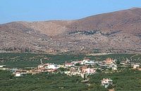 Pediada, Iraklion at 22.3km (SW) Polythéa (GR: Πολυθέα) is located 500 m NE of Kastelli at an altitude of 335m.N Nowadays Polythea has become part of Kasteli and it has 364 inhabitants. Fr. Barozzi mentions it as Apigaiduri in 1577, belonging to the Pediada district and it continues to be known with that name until 1940, when it is re-baptized with its current name, Polythea. The previous name of the village, Pigaidouri, is originated by the word ‘pigaidi', which is Cretan for ‘pigadi', which means ‘a well'. It is a nice name that propably has been changed due to the fact that people thought it was a reference to ‘gaidouri', which means ‘donkey'. Apart from the ubiquitous raki and mezedes served at the kapheneions, you can also find rooms for rent. A typical Cretan feast is held here on August 15th for the Virgin Mary (Assumption). 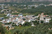 Pediada, Iraklion at 22.5km (SW) Diavaide (GR: Διαβαϊδέ) has 120 inhabitants and lies very near to Kasteli (700m to the SE) at 355m above sea level. The earliest reference to the name is found in the Ducal Archives at Chandax in 1378. Another document in the same archives mentions a certain G. Dochiano, inhabitant of Diavaide. In an inscription, found in the Byzantine church of Agios Georgios Sfakiotis, the name of the village is clearly mentioned, indicating that Diavaide existed well before the Turkish occupation. In that church there is a unique fresco of Byzantine art that represents Saint George and Saint Demeter passing through the sea on their horses, while at their feet lie various sea creatures; crabs, lobsters, and other fish, a strange phenomenon indeed, considering that the village is so far away from the sea. There is also the church of Agios Nikolaos in the village dated to the same period. The village took part in all the main fights by Crete against the enemies of its freedom, while during German occupation the high college of Kastelli continued to operate in Diavaide houses. The cultural association of the village, one of the first in this area, strives to maintain the cultural traditions and the continuity of village history through the years. 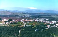 Pediada, Iraklion at 22.9km (SW) Kastelli (GR: Καστέλλι) is a small town in the countryside of the province of Pediada. It has over 2000 inhabitants and provides all the modern facilities and public services its residents and/or visitors may need. Many events are organized through the year by the municipality, the school and the cultural centre. In August a special festival, known as the Feast of Xenitemenou (ex-patriot feast) includes concerts, folklore, exhibitions and theatre plays.
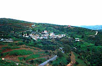 Gouves, Iraklion at 23km (W) Vorou (or Voritsi) lies at a height of 230 m. above sea-level and counted 62 inhabitants in 1981 and 48 in 2001. It is 25 kms away from Heraklion. To get there, you follow the National Road to Aghios Nikolaos and at kms 17.7 turn right, taking the road Gouves-Skotino- Vorou. Nowadays it is known as Voritsi but this name is not official. The name Vorou, on the other hand, in the district of Pediados is mentioned by Barozzi in 1577. At the beginning of this century there lived a wise man and a healer in the village of Voritsi. His name was Giorgos Konstantoulakis and people flocked from all over to Crete to seek his advice.
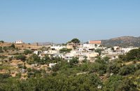 Pediada, Iraklion at 23.4km (SW) Mathia is 11 km to the SE of Kasteli, has 215 inhabitants and lies at 590 m above sea level, in the foothills of the Afendi mountain (1578 m), with the Dikti mountain in the background. The earliest reference to the village can be found in several contracts of 1271 where the notary of Chandax P. Scardon mentions commercial exchanges of grain and wine with residents of the village ‘Mithie’, possibly a misspelling for Mathia. The name derives from the common first name for girls, ‘Mattia’, which in Crete is pronounced ‘Mathia’. Burials in jars of the middle Minoan period were discovered in 1957 close to the village, in a place known as Stavroplaka. To the NW of the village, at Katalimata, a Late Minoan site with important finds and, 200 m further off, a settlement with large walls still in place were also found.There are wonderful Byzantine wall paintings in the two churches of this traditional village, the church of Koimisi tis Panagias (Dormition of Our Lady) and the church of Agios Giorgos. At Metochi, in beautiful surroundings where the historical holm-oak of Ismail Pasha stands among plane trees and running water, there are camping facilities. You can also visit an old factory and several ruined mills. The village boasts of several kapheneions where they serve raki and ‘mezedes’ (tit-bits). There is an active cultural centre, that organizes events especially in the summer, with evenings of Cretan music and theatre plays. The most important and traditional feast is held on the Sunday of Agioi Pantes, 50 days after Easter. Image Library
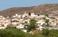 Pediada, Iraklion at 23.4km (W) The village of Smári (GR: Σμάρι) is a traditional Cretan village, only 10 km away from Kasteli and has 375 inhabitants. In it you will find beautiful old stone houses that have been restored, picturesque little alleys, ruins of older buildings and pottery workshops where you can purchase copies of Byzantine and Minoan ceramics. There are also some interesting churches with wonderful frescoes like the one dedicated to Sotir Christos, the Koimisi tis Panagias and Agios Giorgos. The earliest reference to the village of Smari dates back to 1375. There is a lively Cretan feast on July 20th in honour of Profitis Ilias, with much rejoicing, singing and dancing. 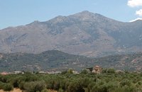 Pediada, Iraklion at 24.5km (SW) 330 m above sea level, just out of Kasteli (1.5 km) to the east, lies the village of Archangelos (GR: Αρχάγγελος) with 433 residents. It was founded in 961 by the military forces of Nikiphoros Phocas and was originally named ‘Varvaro’, and was still known by that name in 1583, where the Chandax Register puts it down as a village of the Pediada district with 37 inhabitants. Its name was changed only recently, in 1961, to Archangelos, and the main village church in the square is dedicated to the Archangel Michael. There is another smaller and older church, that of the Panaghia, with Byzantine wall paintings. Remains of ancient mills can still be seen. In a location known as Trochalos, archaeological finds have brought to light a series of Minoan tools dating back to the first and second Late Minoan periods. As in every Cretan village, raki and ‘mezedes’ are always available at the kapheneions. The feast of Michail Archangelos on November 8th is celebrated with much feasting in the village. 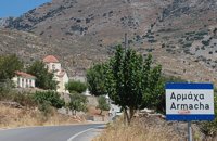 Pediada, Iraklion at 24.9km (SW) Armacha (GR: Αρμάχα) lies at 490 m above sea level, at a distance of 7km from Kastelli, with 110 residents (census 2001) and is first referred to by Barozzi in 1577. Armacha is rich in the production of agricultural and livestock products. The Metropolitan Bishop, Tirnovos Voulgaria Ilarionas Kabanaris Sinitis was born, and is also buried here. A man of advanced learning, he wanted to translate the Bible to Demotic Greek. 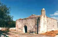 Pediada, Iraklion at 24.9km (SW) At an altitude of 380m, with 63 inhabitants, Liliano (GR: Λιλιανό) is first mentioned in the Turkish census of 1671. The Basilica with its three naves, dedicated to Saint John, was built in the 12th -13th centuries and is one of the oldest and the most interesting in Crete. The stones used in its construction came from earlier buildings. The three naves, with the middle nave higher than the other two, are supported by columns in Ionic style. The narthex in front is lower with wider arches, whereas the door and windows have pointed arches. 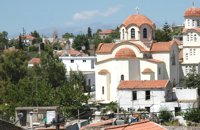 Pediada, Iraklion at 25.4km (SW) Apostoloi (GR: Αποστόλοι) is a village in the area of Kasteli, 360 m above sea level. It has about 490 inhabitants, and is located on the 32 km of the road leading to Kasteli in the NW part of Apostolianos Kampos, among vineyards and olive groves. Until recently tannery was a main activity among the villagers. The earliest reference to the name is to be found in a contract drawn in 1279, where Sancti Apostoli et Sophoro were lands belonging to the Venetian lord Leonardus Gradonicus, who gave them and leased them to Petro Quinino. There is another mention of the name in a document dated to 1378. It is also quoted by Fr. Barozzi in 1577 as forming part of the Pediada district. The name of the village finds its origins in the name of an old church dedicated to the Saint Apostles. The present church was built on the same site in the 19th century, in 1876. The church of Agios Giorgos is Byzantine and has wall paintings. According to village tradition, on the night of Easter in 1841, the Turks caught the Cretan leader of the revolution for the Eastern part of the island, Giorgos Vassilakis, or Vassilakogiorgi and hanged him from a fig tree.The village kapheneions serve particularly good raki and on June 29th there is a great feast in the honour of the Saint Apostles, Peter and Paul. 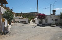 Pediada, Iraklion at 25.7km (SW) Village of the area of Kastelli with 115 residents, Agia Paraskevi is situated 5 km northeast of Kastelli at an altitude of 400m. It is first mentioned in the Turkish census of 1671 as Agia Paraskevi tou Xourdou with 17 haratsia (head tax). It is very possible that Santa Venerata, a village mentioned in 1463 by Cardinal Bissarion, is the name by which Agia Paraskevi was known at that period. 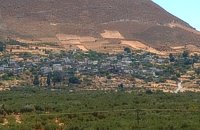 Pediada, Iraklion at 25.8km (SW) Geraki (GR: Γεράκι). This lovely village of 375 inhabitants is located on the western slopes of the Lassithi mountains between the peaks of Afendi (1578 m) and Sarakinos (1588 m) in a beautiful glen, 520m above sea level and only 9km SE of Kastelli. It features an interesting Byzantine church, dedicated to the Archangel Michael (Archangelos Michail) with wall paintings that have not been maintained and some interesting (movable) icons by the local painter, Sepis. The active cultural centre of Geraki organizes many events during the summer season. Twice a year the village has a typical Cretan feast in honour of its patron saints: Agia Paraskevi on July 26th and Michail Archangelos on 8th November. The village produces agricultural products and great cheese that led to a specific cheese celebration. From Geraki you can also reach the lovely chapel of Agia Anna, driving through a particularly beautiful landscape with a spectacular view over the Geraki glen and fresh running water, a place ideal for a picnic. Image Library
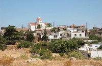 Pediada, Iraklion at 26.2km (SW) Evangelismos (GR: Ευαγγελισμός) at 360 m above sea level, with 365 inhabitants, lies to the SW of Kasteli, distant only 5 km from the county town and about 35 km from Heraklion. In earlier years, the village was called Mouktari or Mouchtari and its name figures in a 1381 contract for the buying and selling of grain. The Byzantine church of the Panagia is worth a visit. On August 6th the village celebrates the feast of the Metamorphosis. Evangelismos is the seat of the newly (2010) created municipality, according to the National "Kallikratis Project", by uniting the former municipalities of Kastelli, Thrapsano and Akalochori. The name of the new municipality is "Minoa Pediada" 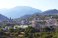 Ierapetra, Lassithi at 26.8km (S) One of the largest villages of Crete, in the north of the valley of the river Sarantapichos. It is 28 km away from Ierapetra and 40 km away from Aghios Nikolaos, in a verdurous slope within immense olive groves, with an unlimited view to the valley of Myrtos, the Libyan Sea and the mountain peaks that surround it. 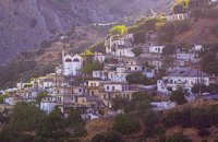 Ierapetra, Lassithi at 27km (S) At a mountainous, precipitous site, in the west mountain slopes of Dikti, at an altitude of 550 m above sea level and at 2 km from the village of Malles, is built the village Christos (GR: Χριστός – Christ). Christos is a beautiful, verdurous village, with many running waters, traditional, unchanged by time, with narrow sloping cobbled alleys. Image Library
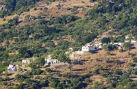 Ierapetra, Lassithi at 27.8km (S) It is a small village with few residents, loacated 4 km to the west of the village Christos at an altitude of 600 m. The residents of Metaxohori (GR: Μεταξοχώρι, or Parsás - GR: Παρσάς) have immigrated to the plains of Ierapetra, in Stomio, Ammoudares and Xerokampos and work in the glasshouses. The village has been renamed in 1955 from Parsas to Metaxohori to honor the Ecumenical Patriarch Meletios Metaxakis who was born here. 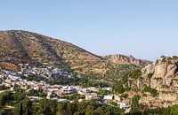 Ierapetra, Lassithi at 29km (S) One of the most beautiful parts of the hinterland of Ierapetra is occupied by the picturesque village of Kalamafka. It is situated on the edge of the Lassithi mountains, an area known for its impressive diversity in landscape. Kalamafka sits at an altitude of 480 meters, 15 kilometers from the town of Ierapetra and 25 kilometers from Agios Nikolaos. Kalamafka is a picturesque, large, and prosperous village surrounded by unique natural beauty. The springs at Kefalovryso, with its plane trees and lush vegetation, as well as its old historical churches, gorges, and springs, attract visitors due to the oasis-like coolness it offers in this otherwise dry and hot region. The village's wealth lies in its water sources and the vitality of its residents, who resist urbanization. Another reason for Kalamafka's enduring population is its advantageous location, as it is centrally positioned between the north and south coasts of the island, drawing daily visitors from Ierapetra and Agios Nikolaos. History: The village derives its name from "Kali Afkla," a wooden channel that was once used to transfer water from one riverbank to another at the springs of Kefalovryso. Another explanation for the name is that the rock formation on Kastelos Hill resembles a Greek Orthodox priest's hat (kalymafki). Kalamafka, known as ancient Larisa, has been inhabited since the Minoan era. In the Psathi area, along the road to Ierapetra, archaeological findings such as human skulls, clay pots, spearheads, and various grave goods from the sub-Minoan era have been discovered. The geographer Strabo mentions Kalamafka, ancient Larisa, as follows: "And in Crete there is the city of Larisa, which now is united with Ierapytna, and from which the plain below, called Larision, takes its name." The god protector of ancient Larisa was Asclepius, and this is why the Medical Association of Lassithi has adopted the figure of a statuette discovered on the Kastelos peak, which overlooks the village and served as a peak sanctuary according to Mr. Michalis Pytikakis. Larisa was conquered around the 3rd century B.C. by Ierapytna, and its residents were relocated as per the terms of the treaty. Evidence from subsequent historical periods suggests that the Kalamafka area has been continuously inhabited due to the presence of the water sources of Kefalovryso. Place names like Kastelos, Mesokastela, and Larisakia attest to its historical significance. Kastelos Hill, serving as the seat of a feudal lord during the Venetian rule, had 435 residents in 1583. It boasted several notable Byzantine and post-Byzantine churches, along with numerous chapels. During the Turkish rule, it was a breeding ground for prominent chieftains like Nikolaos Foniadakis and Ioannis Baritakis. The village's history is marked by struggles and sacrifices that cannot be easily summarized. Today, Kalamafka is a vibrant village with a growing population. It has a two-seat school, a nursery school, a cultural association, numerous coffee houses, and seven taverns. The natural landscape, often referred to as "Chinese" due to its small rock pillars with bonsais, stone formations, and Kastelos Hill with its 224 steps, is considered a monument of natural history. Kalamafka offers visitors a wealth of attractions, including caves, rock paintings, the Havgas gorge, an ancient olive press, and the churches of Saint John and Saint Anthony. The taverns, shaded by plane trees and surrounded by running water, serve traditional and delicious local dishes, including the traditional "klostenios" halva and skyfomakarounes (local pasta). The sounds of the lyra, violin, and lute add to the ambiance, pleasing both locals and foreigners. There are indeed many compelling reasons to visit Kalamafka. By Toby Robert Image Library
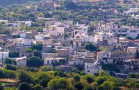 Ierapetra, Lassithi at 30km (SE) Between OLEROS and OLERIA there is the village Meseleroi, which took its name from the ancient OLEROS. It is situated at 10 km in the north of Ierapetra at an altitude of 360 m. Ancient Oleros flourished during the classical times, to be conquered by thepowerful Ierapytna. Oleria was a place of worship for Oleria Athena, with its famous statue, venerated by the residents of Oleria and Ierapytna. |
||
|
| ||
C
O
N
T
E
N
T
S
O
N
T
E
N
T
S


