interkriti®
YOUR GATEWAY TO CRETE
|
Crete
: Sightseeing
List Grid Map
Found
5
- Showing :
1 - 5
 archaeological site in Kissamos at 0km (N) Polyrinia (GR: Πολυρρήνια) was one of the most important cities-states of the Western Crete.It was built amphitheatrically on top of the hill (418 m altitude) with a commanding view of both the Cretan and the Libyan sea, located 49 km from Hania and 6 km from Kissamos . The history of Polyrinia starts in the Minoan period and continues to the present day.
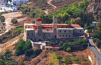
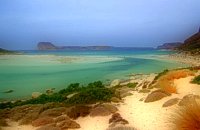
 Kolimbari, Kissamos at 15.1km (NE) The monastery of Gonia (GR: Μονή Γωνιάς) or Panagia Odigitria, is located 1 km north of Kolimbari (along the Spatha penninsula) and 24 km from the city of Chania in a wonderful place with a magnificent view to the bay of Hania. It was built in the 17th century, in the Venetian fortress style, and it is dedicated to the Assumption of the Virgin. The monastery replaced an older, 13th-century structure, which was located on the territory of an adjacent cemetery.  Gramvoussa Cape, Kissamos at 15.3km (NW) West of Kissamos and north of the beautiful village of Kaliviani, stretches the impressive Gramvoussa peninsula. The peninsula is formed by steep rocks and is covered with thyme and origanum bushes and wild flowers. On the north west side of the peninsula opposite to the island of Gramvoussa is the wonderful beach of Balos (GR: Μπάλος). The beach is covered with fine white sand and is located between the two creeks of the Tigani cape. The same white sand covers the bottom of the sea and grants to the sea an emerald color. In front of the beach is the picturesque island of Gramvoussa and on the back is the Geroskinos mountain (altitude 762 m). The road from Kaliviani is well paved dirt road, with amazing view to the steep rocky seaside of the east side of the peninsula. The road ends one-two km before the beach, and the visitor can follow a paved road to Balos. North of Balos, at the Korykon cape, are the ruins of the small Roman city of Agnion, with a temple of the God Apollo. There are small boats, offering daily cruises to Balos and Gramvoussa, departing from Kissamos (Kastelli) during the summertime. Image Library
 Gramvoussa Cape, Kisssamos at 18.2km (N) Due to its strategic location, Gramvoussa was fortified by the Venetians, who built a well-fortified castle on the top of a steepy rock at an altitude of 137 m. Construction on the castle of Gramvoussa started in 1579 and ended in 1582.
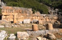
 Ancient town in Selino, South Hania at 26.8km (SE) Located ~2.3km west of Sougia it was the religious centre of the cities in south-west Crete and the port of Elyros. It flourished during the Hellenistic and Roman periods. In 1957-58 Asklepieion was excavated by N. Platon. The most important monuments of the site are: The Temple of Asklepios, dated to the Hellenistic and Roman periods, Part of a Roman theatre, Rock-cut and built chamber tombs. There two byzantine chapels dedicated to Our Lady and Agios Kirikos The beach in the small cove has coarse pebbles and clear waters. Lissos (GR: Λισσός) nowadays is uninhabited and can be reached from Sougia only by foot (~1& 1/2 hours walk) or by boat (~20 minutes). 1
|
||
|
| ||
C
O
N
T
E
N
T
S
O
N
T
E
N
T
S


