Eleutherna
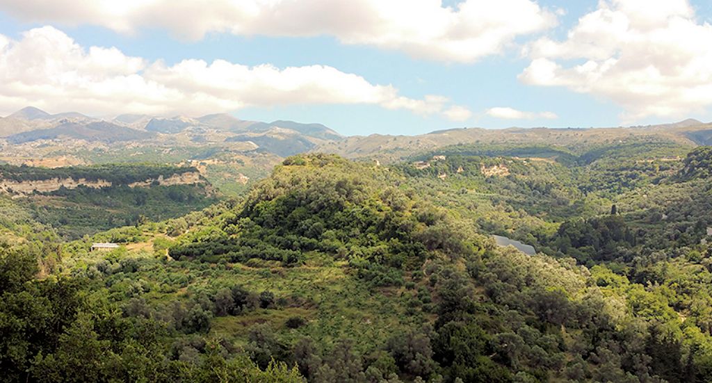
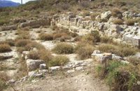
Ancient Eleutherna (Eleftherna GR: Ελεύθερνα) is located at a distance of around 25 km. to the SE of Rethymnon and occupies two long, narrow ridges, called Pyrgi and Nissi. Three streams flow around the foot of the hills and join to the north of them. The urban centre of ancient Eleutherna was always located at Pyrgi. Ruins of Hellenistic walls and buildings, Roman structures and an Early Christian basilica are preserved on the east slope of the hill. On the west slope of the hill, at the site called Orthi Petra (standing stone), lies the cemetery of the Late Geometric and Archaic periods, part of which was covered by the Roman buildings. Remains of a settlement that flourished in the Hellenistic period have been uncovered on the Nissi hill.
Current archaeological evidence shows that Eleutherna was one of Crete’s most important ancient cities, a capital city of the Geometric and Archaic periods – that is, the periods when the Homeric poems were disseminated and recorded in writing. The city minted its own coins in the fourth century BC. In the third century BC, Eleutherna fought against Rhodes and its ally Knossos. In 220 BC, when the Cretan cities fought against each other, Eleutherna sided with Knossos, but a siege forced it to break the alliance. In 68 BC, when the Roman general Metellus attacked Eleutherna, the city managed to resist for some time because of its fortified location, but was finally conquered through treason.
The poet Linus, the philosopher Diogenes, the lyric poet Ametor, and the sculptor Timochares, father of Pythokritos of Rhodes (by adoption), creator of the famous Victory of Samothrace, were all natives of Eleutherna.
The first excavations on the site were carried out in 1929 by the British Archaeological School under the direction of H. Payne. The area has been systematically excavated since 1985 by the Department of Archaeology and Art History of the University of Crete (by Mr Nikos Stambolides, Professor of the University of Crete and director of the Museum of Cycladic Art in Athens.). Excavations are carried out in three sections of the site: a) Katsivelos, b) Pyrgi and Nissi hills, and c) Orthi Petra.
The most important monuments of the site are:
 Part of a defensive tower.
 It stands at the north end of the narrow passage which is the only natural access to Pyrgi hill from the south. The tower was used from the Hellenistic until the Byzantine period.
Hellenistic bridge. It is located to the north of the city, near the

junction of the streams flowing on either side of the two hills. The bridge is partly hewn from the rock and its triangular arch is built in the ecphoric system. Dated to the Hellenistic period (330-67 B.C.).
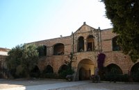
Early Christian basilica at Katsivelos. Three-aisled basilica with a narthex. Two rows of columns divide the interior into three aisles of which the two lateral must have had a second floor. The stone iconostasis is decorated with floral motifs and crosses. The mosaic floors, decorated with geometric and floral patterns, are also preserved. Dated to the 5th-7th centuries A.D.
 Rock-cut cisterns.
 Impressive pillared cisterns quarried out in the rock at the south side of the Pyrgi hill. The water was carried to the city on the eastern part of the hill by means of a vaulted aueqduct. The structures are generally dated to the Roman period but an even earlier date should not be excluded.
 Cemetery at Orthi Petra.
 The cemetery was used from the late Protogeometric until the early Archaic period (870/850-600 B.C.). A variety of burial practices has been observed, including simple inhumations, inhumations in pithos or amphora and cremations. Grave enclosures, funerary monuments, architectural and free-standing sculptures were also uncovered in the area.
Massive peribolos at the south end of Nissi hill. It is rectangular in plan, built of large ashlar blocks and was entered by a Doric propylon with five columns, in the middle of the west long side. Dated to ca. 400 B.C.
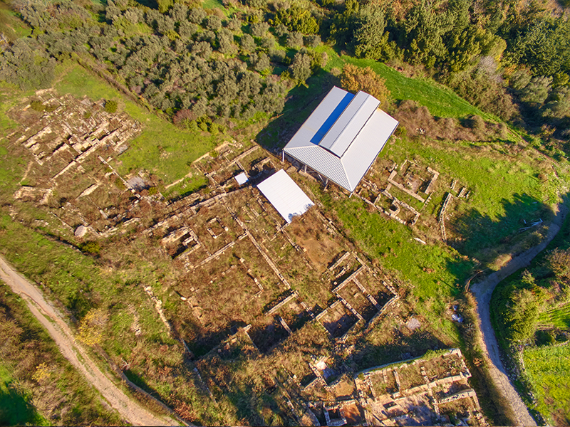 Hellenistic settlement at Nissi.
 Section of a Hellenistic settlement (330-67 B.C.) which is gradually uncovered by the recent excavations. The layout follows the natural slopes of the hill and not a regular pattern. Large parts of the rock were hewn in order to provide building areas. Each house covered an area of around 200 sq.m. and was provided with a cistern for the collection of water.

Explanatory signs that facilitate browsing of visitors to the site.
Click the image to view larger map >>